


014
OCT
MORD is a software tool that transmits and visualises data from radiation survey equipment in real time. Measured data travel over the 4G or 5G mobile network to a central server, where they are processed and published in an ordinary web browser — the Radiation Protocol. Together with database tools for administration and controlled data flow, processing and analysis algorithms and a map-based front end, it lets the responsible units read the radiation situation in an area of interest as it develops, and decide quickly.
The tool was developed within project VB01000012 “Multi-criteria Operational Radiation Document”, part of the security research programme of the Czech Ministry of the Interior 2021–2026 — Development, Testing and Evaluation of New Security Technologies (SECTECH), first public call. It is the result of the cooperation of three institutions: SÚJCHBO, v.v.i. (National Institute for Nuclear, Chemical and Biological Protection), GEORADIS s.r.o. and the Faculty of Nuclear Sciences and Physical Engineering, CTU in Prague. Bringing together a commercial company, a research organisation and an academic institution makes the best use of the available expertise in radiation protection and nuclear safety.

Walkover, cart-borne & airborne survey in one insrument.
Live picture of the radiation situation.

The protocol collects a set of criteria and requirements presented both as text and graphically, so the radiation situation can be assessed immediately. It can be updated continuously, which makes it possible to follow how the situation evolves over time. Selected units of the Czech Police and of the Fire Rescue Service use it when training their response to incidents involving contamination by radioactive substances or nuclear material.
How the data get to the operator
Data from the survey instruments are transmitted over 5G or 4G, depending on coverage. Where the mobile signal is insufficient, readings are stored on the instrument and uploaded to the main server once the crew reaches a covered area. On the server the data are processed and prepared for display; the operator sees them with a delay of a few minutes at most (3 minutes on average).
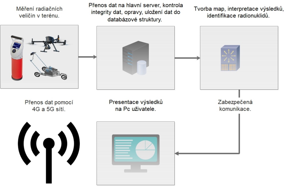
Simplified schematic of data transmission and processing in MORD.
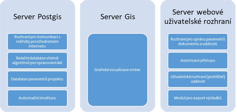
Structure of the Radiation Protocol program.
Instruments connected to the system
The current state of the system allows the following survey equipment to be included in an operation: GT-40 for walkover surveys, RT-58BG for cart-borne surveys and D230A for airborne monitoring.
GT-40 — a multifunction digital gamma-ray spectrometer for rapid determination of gamma source activity in the field. Measured points are recorded in the instrument’s memory together with their geographic position. For MORD the GT-40 firmware gained a First Response Mode, which pairs the instrument with a mobile phone that then carries the data to the main server.
RT-58BG — a cart-borne monitoring system designed for mapping the consequences of large-scale surface contamination in built-up urban areas, with the detection assembly carried on a hand-pushed cart. Its modularity allows fast radionuclide identification and distinguishes horizontal from vertical contamination. The system carries five NaI(Tl) 3″ × 3″ detectors, arranged so that the directional characteristics of the incident ionising radiation can also be determined, plus a beta detector. Within MORD it was modified to connect to a mobile phone that relays the readings to the main server, while the operator keeps the full picture on the instrument’s LCD display throughout the operation.
D230A — a lightweight gamma-ray spectrometer for UAVs with a small payload capacity. It uses two 1024-channel NaI(Tl) spectrometers with a compact data acquisition and control unit, and stabilises automatically on the natural background. Spectra from both detectors are collected and stored separately at a scan rate adjustable from one second to one minute. Within MORD its software was adapted to deliver monitoring results both to the survey operator in the field and, in real time, to the main server.
The system can be extended with further survey equipment as required. Any such instrument has to be able to transmit its readings over the mobile network in the standardised format available on request from the project team. Alternatively, a communication module can be built that links the instrument to the main server and adds GPS coordinates to the measurements.
Working with the administration
MORD runs in a web browser window. After entering the web address, the user signs in with the credentials assigned to them; credentials are issued by the project team on request.
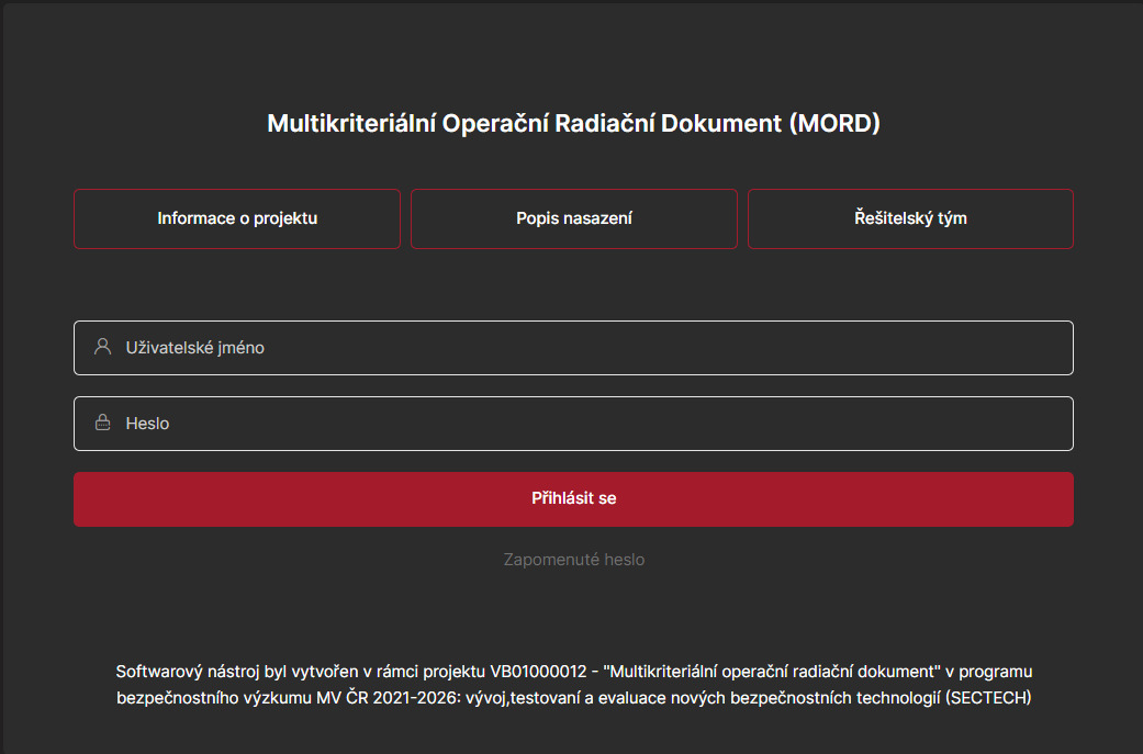
The sign-in page.
The next screen is used to create and administer individual events and to manage the survey instruments. For each event the user can edit the description and time frame, and also the legend thresholds used to display the ambient dose equivalent rate (H*(10) rate). The three-level scale follows the Chemical Service Regulations of the Fire Rescue Service of the Czech Republic — Annex 9 to Directive No. 6/2017 of its Director General (radiation intervention of type I and II under the Fire Brigade Combat Regulations — N4). The class boundaries can be changed after the event is closed, which is useful for ex-post analyses.
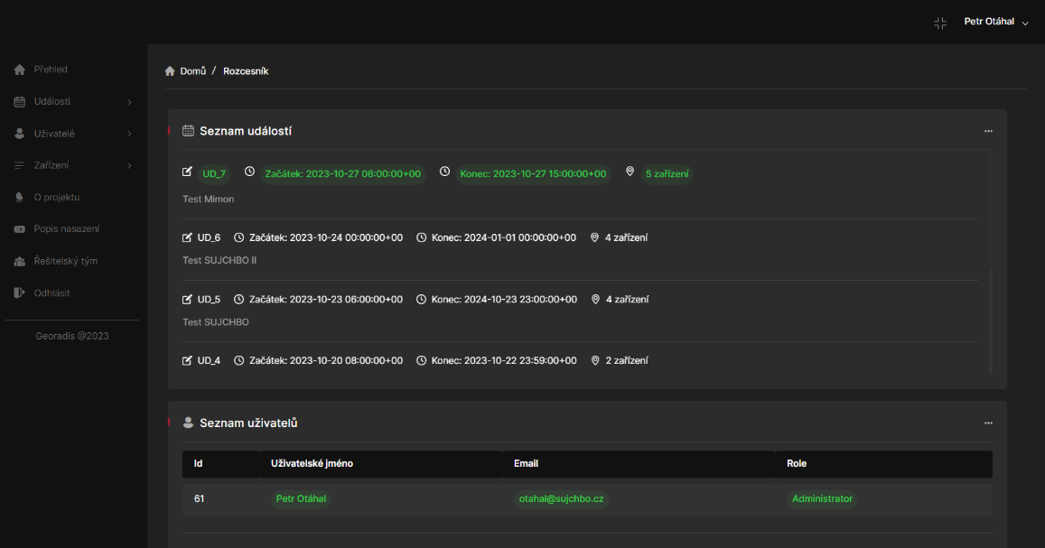
Administration of events and survey instruments.
The same part of the program shows how many new readings each connected instrument has delivered. With several instruments in the field, this makes it easy to see whether they are all connected and reporting at the defined intervals, and when each one last sent a set of results.
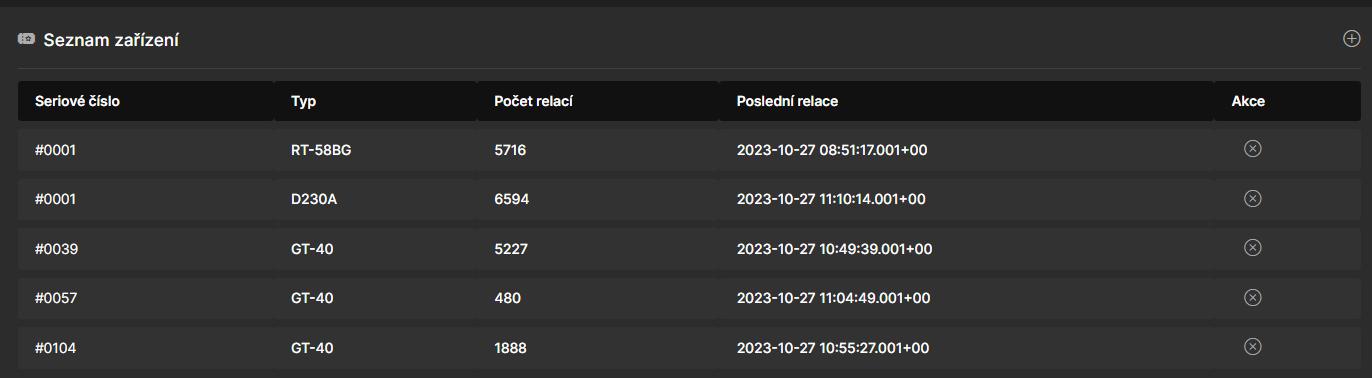
List of activated survey instruments.
Working with the map
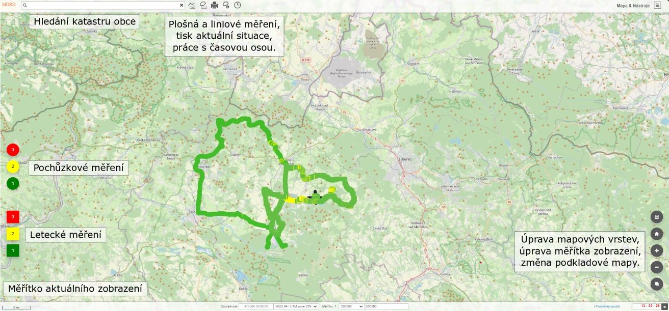
Once an event has been created or selected, access to its graphical presentation is authorised separately. Both closed events and events running in real time can be followed. The map window is intuitive: every active element carries an information tooltip that guides the user to the command they need. Besides the display itself, a range of tools (distance measurement, area measurement, marking points in a selected area, …) lets the user analyse the ongoing event.
The map window of the MORD program.
Even during a live operation, the user can monitor the size of the surveyed area or the length of the surveyed route, switch the base map to generate snapshots of the current state, and turn individual map layers on and off.
Status
Realized
Related products & tools
Instrument RT-58BGIn project with us
FJFI ČVUT
SÚJCHBO
Categories
Monitoring
Security
Urban